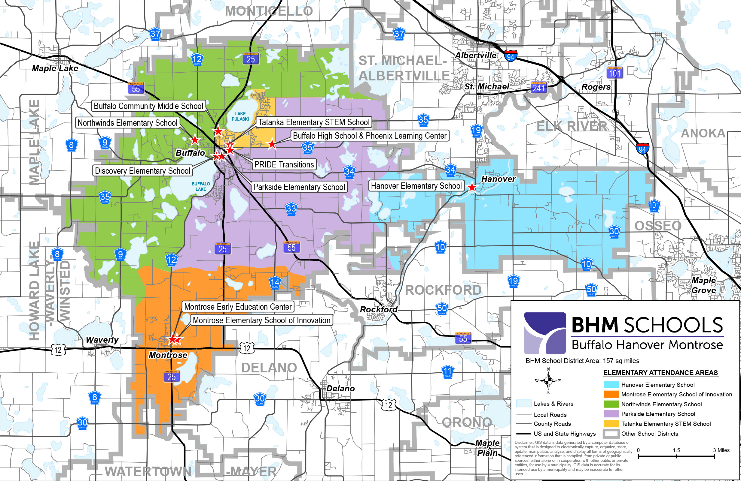
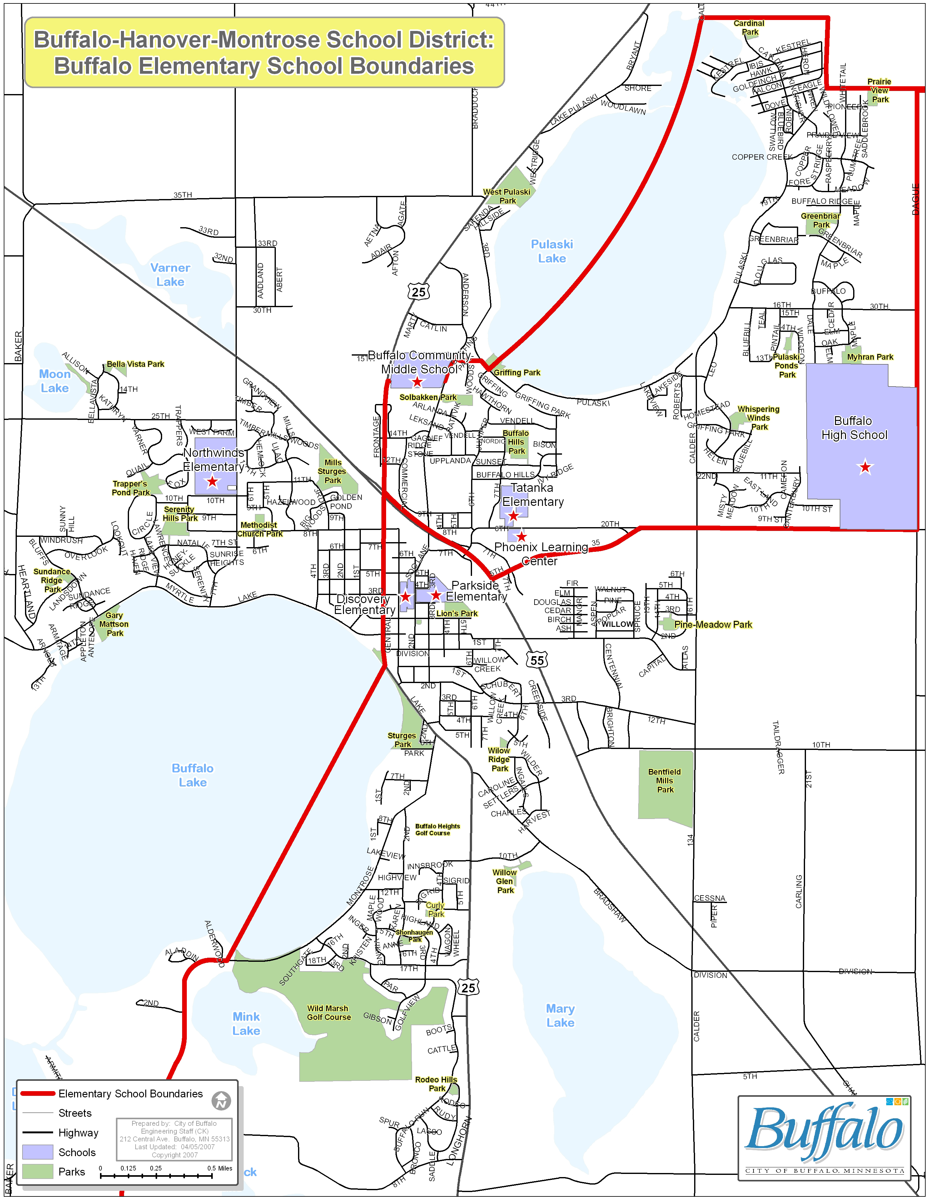
For an interactive school district boundary map that allows you to zoom in to the level of individual streets and properties, see this map from ArcGIS Online. (Follow the link, click "Add" from the top of the tool bar on the left, then click "Browse Layers," search "School District Boundaries," and select "School District Boundaries - Current" to add to the map.)